



Separate the zone record from access enforcement
A Lexoh zone is a named area or grouping used in a site’s configured access and reporting model. A visitor car park, staff area and loading area may need separate records because their permissions, entrances or counting rules differ. Define that purpose before drawing a map or entering a capacity.
Three relationships need checking: which physical entrances serve the zone, which credentials may use those entrances, and which events change its occupancy count. A name, colour or polygon does not establish these relationships by itself.
The available fields and controls depend on the installed version and administrator permissions. Use the procedures confirmed for your installation when saving or activating a change.
Review the existing zone before editing
An access-granted event, a detector-confirmed passage and a parking-space sensor reading are different observations. Determine which source updates this zone before treating its displayed count as occupied spaces.
- Select the intended site and open its zone-management area. Locate the zone by its name and record reference; check for similarly named records before making changes.
- Read its description, status, capacity settings and any displayed count. Establish whether the count represents vehicles, people or another configured unit, and note its update time.
- Identify the associated entrance and exit devices, relevant credential groups and schedules. Check whether a rule is assigned directly or inherited from another configuration.
- Record the current settings and expected change. Confirm the operator’s permissions and the supported way to restore the previous configuration if validation fails.
Create a zone with a defined operational purpose
- Document the area, responsible operator, counting unit and intended access policy. Use a specific name such as “North visitor car park” and describe which entrances it covers.
- Create the record using the supported controls. Enter the approved capacity and any required location information; check what empty or zero values mean before saving.
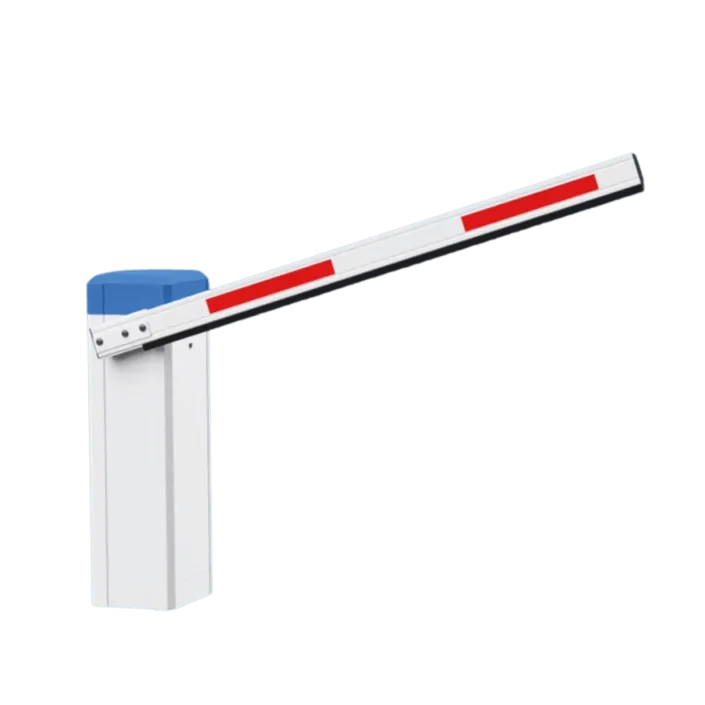
- Associate the correct devices and direction of travel. For movement between two zones, establish which event leaves the first zone and enters the second.
- Assign the intended permissions and schedules through their configuration controls. Define any pricing relationship separately; a zone name does not create a tariff.
- Review map geometry where the installation uses it. Compare the saved area and device assignments with the site layout.
- Before operational use, verify configuration receipt and run approved entry, exit and refusal checks. If staging is supported, confirm its behavior and the activation procedure.
Understand what each setting changes
Name and description
Use names that staff can distinguish in lists and event records. Keep a stable record reference in change notes. A visible name is not necessarily the internal identifier used by connected services.
Active or inactive status
Confirm which rules and devices use this state. Do not assume an inactive zone makes every controller refuse entry or changes the physical position of a door or barrier. Check update receipt and the observed behavior.
Assignments and overlapping areas
Document shared entrances and transfers between areas. A visual overlap is not, by itself, evidence of an access-rule conflict. Confirm how nested or overlapping zones are supported and avoid counting the same passage twice.
Removing an unused zone
Review linked devices, permissions, reports and historical references before changing or removing the record. Use an archive function only if supported, and verify what it retains. Keep a record of the approved replacement or closure.
Interpret capacity, occupancy and offsets separately
Use the capacity approved for the area and its operating purpose. A map’s area or a software count does not establish that capacity. Keep the counting unit consistent: a vehicle count and a person count cannot be compared as though they were the same measure.
Where an occupancy offset is available, verify its sign, scope and effect in the installed configuration. A numerical buffer does not allocate individual spaces, grant a privileged credential access or guarantee room for a particular vehicle. Those requirements need their own operating arrangements and permission checks.
Illustrative calculation only: maximum 100 vehicles, recorded count 85 and a subtractive buffer of 10 give 100 − 85 − 10 = 5 remaining before the chosen threshold. The table uses this same formula; it does not assert how Lexoh displays negative values or operates a barrier.
| Recorded count | Arithmetic remainder |
|---|---|
| 85 vehicles | 100 − 85 − 10 = 5 |
| 90 vehicles | 100 − 90 − 10 = 0 |
| 95 vehicles | 100 − 95 − 10 = −5 |
Count source and corrections
Confirm the baseline and which entry, exit or transfer events alter it. Missed passages, duplicated events, open barriers and delayed synchronization can create a difference from physical occupancy. Record the evidence and reason for any authorized manual correction.
Threshold behavior
Test the last allowed entry, the next request at the threshold and an exit that reduces the count. Verify the actual reader decision, sign, notification and count separately, where those functions are configured. Also test the defined behavior when count information is unavailable.
Use the location to identify the site
Enter the address or location information accepted by your installation. If address search or map centering is available, check the result against the actual site rather than assuming the selected address identifies the entrance. A street address may point to a building centre or another access road.
Confirm the site name, entrance position and nearby landmarks. A map location is a visual reference; it is not evidence that a reader is assigned to the zone or that a remote device has received its settings.
Draw a useful map boundary
A drawn outline is an operational reference, not a surveyed property boundary. Use enough points to describe the intended area clearly; adding points or decimal places does not establish positional accuracy.
- Confirm what the polygon is used for in this installation: display, reporting or a specifically configured spatial rule. Do not infer geofenced access from the presence of a map.
- Navigate to the site and choose a view that makes its physical layout legible. Check the imagery against current site information.
- Use the supported drawing controls to place the boundary points in perimeter order. A polygon with area needs at least three distinct points that are not all on one straight line.
- Review the closing edge between the last and first points. Check for crossed edges, unintended sections and confusion with adjacent areas.
- Save using the documented controls and reopen the zone to inspect the persisted shape. Test the associated access configuration separately at the actual entrances.
Check coordinates and point order
Coordinate meaning
When coordinates are shown, confirm the expected coordinate system and order. Latitude describes north–south position and longitude east–west position. Preserve the sign and supported precision when editing or importing values; verify the result on the map.
Order and crossing edges
Successive points define the perimeter. Inspect the full shape after an edit, including its closing edge. If the editor supports reordering, confirm the sequence before saving rather than relying on a point’s number alone.
Deletion and redraw
Keep the previous geometry or another supported recovery record before replacing it. Removing a point changes the adjoining edges; deleting all points may remove the shape. Reopen the saved record and compare it with the intended area.
Geometry and device assignments
Changing a polygon does not prove that entrance devices, permissions or counting rules changed with it. Check each relationship that is intended to change and record the test result.
Make zones recognizable without relying on colour
Where zone colours are available, use them consistently with clear names and descriptions. A colour is a visual cue, not an access permission, occupancy value or priority rule. Confirm where the installed interface actually displays it.
Keep text labels visible so staff can distinguish areas without colour. Avoid using the same visual cue for both a zone identity and an alarm state without an accompanying label. Review adjacent zones at the map scales and screens staff use.
For example, “North visitor car park” and “South staff car park” remain understandable when printed in monochrome. Their different access policies must still be configured and tested at the corresponding readers.
Validate the zone and investigate discrepancies
Completion means the recorded settings and observed workflow agree for the tested cases. A saved polygon or active status alone does not prove that the zone is ready for use.
- Test an authorized credential at the intended entrance and a credential that should be refused. Record the time, device, decision and configuration receipt evidence.
- Compare a controlled entry and exit with the expected count changes. Include transfers between zones if used, and distinguish authorization from confirmed passage.
- Test the configured capacity threshold and the approved disconnected-device procedure. Verify displays and notifications independently of the access decision.
- If a zone appears full early, reconcile the physical observation, count baseline, event history, device direction and offset before changing limits. Do not reduce a buffer merely to remove the warning.
- If a count stops updating, check the selected site and time range, device connection, event arrival and zone assignments. Retest after an approved correction.
- Record the accepted configuration, actual results and unresolved differences. Review it when lanes, hardware, access policies or the physical layout change.